Set aside 35–45 minutes for this walk, starting at Grove Street and looking north down Hillhouse Avenue. Before focusing on any single building, take in the street as a series of physical layers: roadway, planted strip, sidewalk, front lawn, and house. The structures sit well back from traffic, distinctly separate from one another. Their two- and three-story masses, porches, chimneys, and individual front doors give the avenue the feel of a nineteenth-century residential neighborhood rather than an internal campus road.
That initial impression offers a useful historical starting point. Hillhouse Avenue was originally laid out in the late eighteenth century as a landscaped residential avenue rather than an axis for Yale's campus. Over time, Yale acquired and reconfigured many of these houses for academic and administrative use. Today, the street displays several eras simultaneously: an early street layout, high-style villas built for private families, and university nameplates mounted on domestic facades.
Read the scale of the street
Standing at the intersection, count the spatial bands running between the roadway's centerline and a house facade. That unusual width consists of much more than pavement alone. Trees, walkways, lawns, and setbacks create distance before you reach a building wall. The New Haven Preservation Trust treats this landscaped composition as central to the district's character and to James Hillhouse’s role in shaping it.
Some historical accounts describe the original avenue as about 150 feet wide. Treat that figure as an approximate planning dimension rather than a measurement you can verify from a curb today. Subsequent changes to street paving, tree plantings, and property lines complicate a direct tape-measure reading. What remains unmistakable is the generous boulevard scale and the repeated setback of the houses.
Architectural language on residential shells
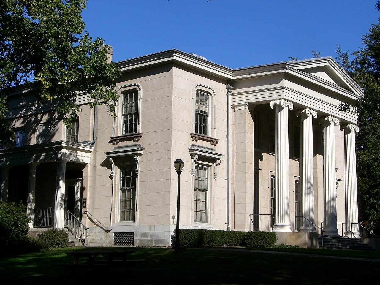
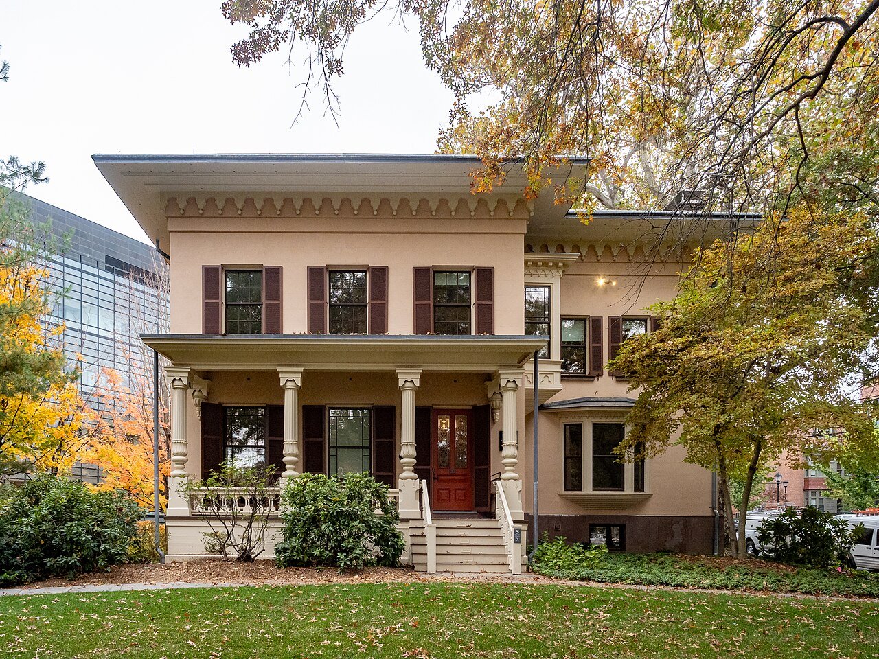
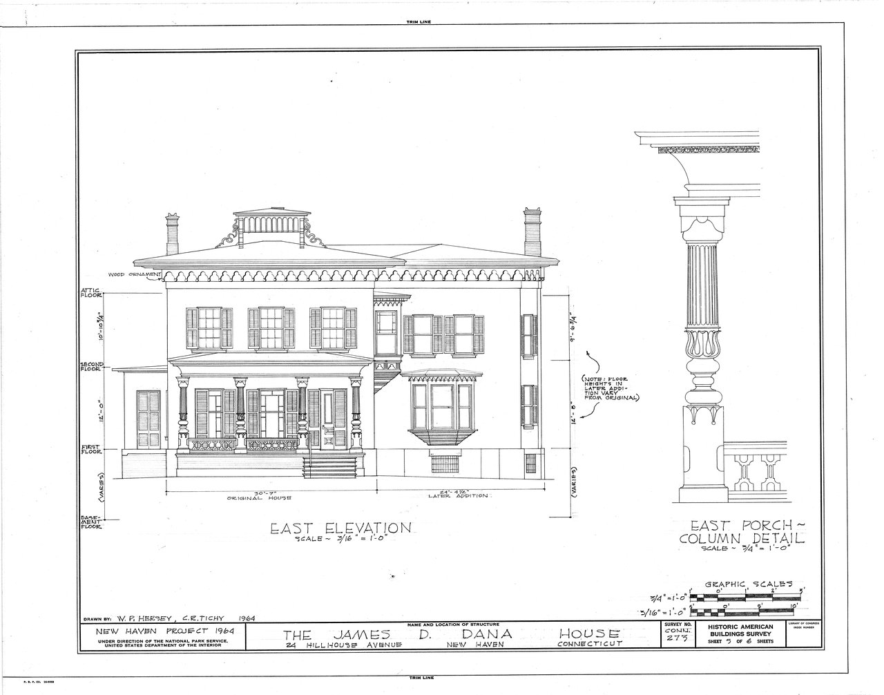
Walk up to 24 Hillhouse Avenue, the James Dwight Dana House, designed by Henry Austin in 1849. Its low roof, deep eaves, brackets, and broad freestanding form mark it as an Italianate villa, though noting these physical details first grounds the style label in what you can see. The New Haven Preservation Trust, National Historic Landmark record, and Yale New Haven Building Archive document its design, its association with geologist James Dwight Dana, and its later Yale ownership and institutional use.
From the public sidewalk, compare it with 35 Hillhouse Avenue, the Prichard House. A prominent colonnade adds formal ceremony to the entrance, yet the lawn, roofline, and overall scale still read clearly as a residence. Do not assume either building is open to visitors. Their value on this walk lies in the visible contrast between domestic architecture and university operations.
The Hillhouse Avenue Historic District covers about eighteen acres and includes twenty-four principal buildings, most dating from 1800 to 1929, according to its National Register nomination. Historic-district status protects the architectural significance of the collection and streetscape; it does not mean that every interior is public or frozen in a single use.
The nameplate tells the next chapter
Continue north through the cluster around 46–56 Hillhouse Avenue. The Jackson School describes its campus footprint as four mansions along the avenue, including Horchow Hall alongside buildings at 46, 52, and 56 Hillhouse. Look for department signs, controlled entries, ramps, and other current-use details attached to the older residential facades.
This is adaptive reuse in practice: preserving a building's shell while changing what happens inside. The concept becomes concrete when you observe the physical evidence. A mansion bearing an academic nameplate offers a much more precise reading than a general assertion that Yale "preserved" or "absorbed" the entire street. Yale occupies many former homes along the avenue, while ownership and specific uses vary by property; avoid turning a strong prevailing pattern into an absolute statement about every address.
Horchow Hall provides a documented example of this progression. Yale acquired the nineteenth-century house in the 1930s, and over the decades it has served several university programs, including the Peabody Museum, the School of Management, and the Jackson School. The building shell persists while institutional functions evolve behind it.
The north end: from Sachem's Wood to Science Hill
As you head further north, notice where the steady residential rhythm begins to open up. Hillhouse Avenue terminates at Sachem’s Wood, a landscaped approach leading up to Science Hill. The Yale Capital Projects account calls it a gateway and records a landscape project completed in 2021 with paths, bicycle routes, stairs, seating, lighting, and drainage improvements.
At this point, the spatial character shifts noticeably. Behind you stand detached houses framed by individual lawns and entryways. Ahead lie paths, rising grades, and the larger structures of Yale’s science district. Science Hill itself is a functional concentration of university facilities—including buildings such as the Peabody Museum and Kline laboratories—rather than a natural attraction, despite its name.
Follow current signs and barriers on site, as construction can alter pedestrian routes. You do not need to enter a science building to grasp how this junction works. Turn around on the slope to look south and watch the avenue recede in perspective between its tree bands. The old residential axis now serves as an approach to a much larger academic district.
Old shells and new functions
Hillhouse Avenue reveals a pattern of campus expansion that did not begin with demolition or the construction of a single new quadrangle. Instead, Yale’s presence became visible address by address, through acquisition, signs, access systems, and adapted interiors. Historic designation helps retain much of the overall streetscape, while institutional functions continue to shift behind the walls.
That combination of preservation and active reuse also outlines the practical limits of your visit. Most of these houses function as working offices, academic centers, or residences rather than public sights. The full reading is available right from the sidewalk: street width explains the avenue’s original planning framework; setbacks and porches reveal its residential form; nameplates mark its current institutional role; and Sachem’s Wood links the entire sequence to Science Hill.
Five questions to take into the field
- From Grove Street, how many spatial bands lie between the roadway and a front door?
- At the Dana or Prichard House, which visible feature most clearly reads as residential rather than academic?
- Between 46 and 56 Hillhouse, which signs or entrance changes reveal current Yale use?
- Where does the regular rhythm of detached houses begin to give way to the Science Hill landscape?
- Which adaptations preserve a residential exterior, and which add an unmistakably institutional layer?