Set aside 25–35 minutes and begin on Temple Street beside the three churches. This road gives you the clearest vantage point for understanding the Green, as it splits a single public space into two contrasting landscapes. The Upper Green lies to the west, toward College Street and Yale, where mature trees shade sloping ground and the facades of Center Church, United Church, and Trinity Church form a firm architectural line. The Lower Green lies to the east, where a broad, relatively level lawn opens around a flagpole beneath an expansive field of sky.
It can be easy to read that contrast as evidence of two separate parks, but notice first what continues across the roadway: grass, tall canopy trees, straight walking paths, perimeter streets, and long views. As the New Haven Preservation Trust notes, the Upper and Lower Green are distinct zones within a single historic civic landscape. Temple Street sharpened that difference when it was cut through the square in 1784, but it also became the axis along which the churches address the city.
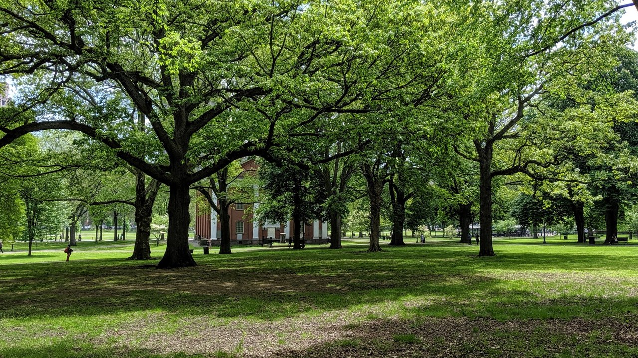
Stand under the Upper Green’s canopy and observe how the space takes shape. Tree trunks break up your view at eye level, while high branches form a ceiling overhead, leaving surrounding buildings and streets visible through the growth. Then cross to the Lower Green, where rows of elms frame the center rather than filling it. This open lawn can accommodate crowds, public ceremonies, and temporary uses in ways the more architectural western side cannot. Ultimately, the Green derives its unity not from visual sameness, but from holding these varied civic settings inside one recognizable square.
Use the city to reconstruct the Nine Squares
Walk toward a corner of the Lower Green and look back along two of its straight edges. Around 1638, New Haven’s original town plat used four crossing streets to divide a larger square into nine sections. As Connecticut History explains, the central block was set aside as common ground—then known as the marketplace—while the eight surrounding sections contained house lots.
The most useful evidence here is not a perfectly preserved diagram, but the persistence of that open center through centuries of urban rebuilding. Broad streets still frame the Green on all four sides, and a cast-iron fence set with granite posts marks much of its perimeter without turning it into a private compound. Straight and diagonal paths carry people across the lawn. While some routes may serve as convenient shortcuts, they should not be dismissed as random tracks: preservation records document paths that were deliberately paved, renewed, and maintained over long periods.
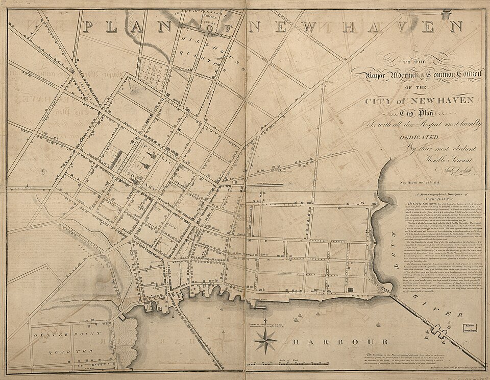
Keep that distinction in mind when reading early maps. By 1817, New Haven already extended beyond its earliest frame, containing many more streets than the original four. The plan does not show nine pristine, equal boxes; instead, it demonstrates how an open center survived while the city accumulated finer divisions and denser development around it. The Green is less an isolated relic left outside urban change than a durable piece of urban structure repeatedly adjusted within that change.
Recognize the history the lawn no longer marks
Next, turn your attention to an absence. Until the early nineteenth century, the Green served as New Haven’s burial ground. Many gravestones were later relocated—including to Grove Street Cemetery—but thousands of human remains stayed below the lawn. The Green’s official history places burial alongside the site's other public functions over time: worship, commerce, government, assembly, protest, and everyday circulation.
That buried layer became visible in 2012, when Hurricane Sandy uprooted the Lincoln Oak, exposing bone fragments caught among its roots. A preliminary study reported by Yale News identified remains from several people who died in the late eighteenth century. While this episode confirms the historical burial ground, it does not turn every hollow or worn patch on the lawn into archaeological evidence. Surface contours are shaped by drainage, tree roots, maintenance, and heavy public use, so responsible observation means knowing where documented evidence ends and conjecture begins.
Center Church’s crypt preserves part of this older burial landscape, though entry is conditional on current opening arrangements. If the crypt is closed, do not treat that as a failed visit. Look instead at the ordinary lawn and consider what happens when a city removes most visible markers while leaving the burials in place. The quietness of the surface is itself historical evidence: public use continued above a landscape whose meaning was increasingly hidden.
Test the boundary between city and university
Return to the west side of Temple Street, cross the Upper Green, and stop at College Street. Directly opposite stands Yale’s Old Campus. Designed by Charles C. Haight, Phelps Hall and Phelps Gate were built in 1896. The Yale New Haven Building Archive describes the gate as a passage from the city into an enclosed university court. Here, “town–gown” is not an abstraction; it is a tangible shift in spatial control across one street.
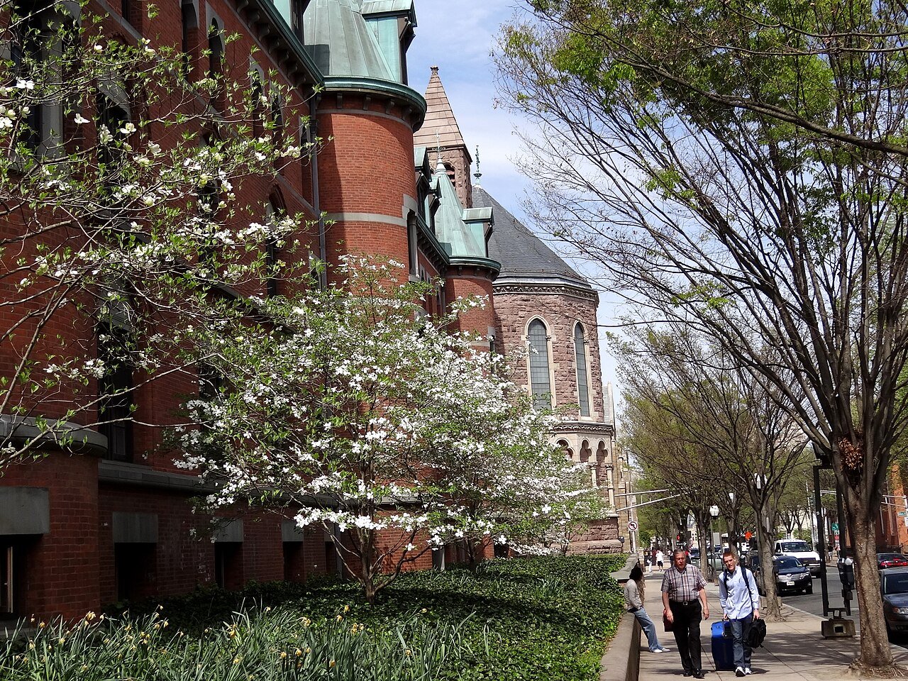
You can compare the two sides from the public sidewalk without assuming entry into Old Campus, as access through Phelps Gate changes with time, events, and security conditions; follow posted rules. The contrast remains legible from the street. The Green accepts approaches from several streets and preserves long views across shared ground. Yale presents a continuous architectural edge, with entry concentrated at a monumental opening. One side operates as civic terrain; the other announces an institutional interior.
Finish by facing the Green again. Calling it a Yale lawn confuses adjacency with ownership and reverses the chronology. The common was central to New Haven’s plan long before Yale established this campus edge. Yale is now an influential neighbor, but the Green’s form was made through the city’s overlapping demands for worship, burial, gathering, protest, passage, and open space. Its most revealing tension is therefore not simply old versus new. It is the coexistence of shared civic ground, buried and sometimes contested histories, and a powerful private institution immediately across the street.
Five questions to take into the field
- From Temple Street, what makes the western Upper Green feel different from the eastern Lower Green, and what still binds them together?
- At one corner, how do streets, fence, paths, and sightlines preserve—or complicate—the logic of the original Nine Squares?
- Which signs of the burial ground are supported by documentation, and which surface features would be irresponsible to interpret as graves?
- At College Street, where do you feel the shift from civic ground to university space: curb, sidewalk, building wall, or gate?
- How do the number, visibility, and conditions of entry differ between the Green and Old Campus, and what do those differences imply about public access?